LiDAR Remote Sensing Payload Instrument (RESEPI)
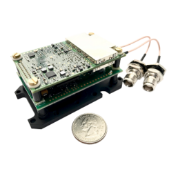
The LiDAR Remote Sensing Payload Instrument, or RESEPI®, is a combined GNSS-aided INS, datalogger, LiDAR, camera and communications system, integrated with a Linux-based processing platform, that allows for the real time and post-processed generation of point cloud solutions, all in one compact and light-weight enclosure.
Description
Overview
Engineered for partners and resellers in the remote sensing industry, RESEPI can be integrated with a variety of the industry leading LiDAR providers including: Velodyne, Quanergy, Ouster, RIEGL and Livox. RESEPI is also designed to work with RGB cameras such as the Sony A6000 or Blackfly FLIR, as well as thermal cameras to combine photogrammetry with point cloud generation. The processing platform contains a WiFi interface, embedded cellular modem to support RTCM corrections, data logging software and gigabit ethernet.
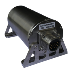
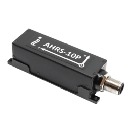
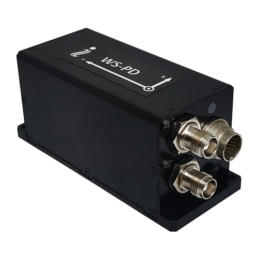
Equipped with an INS from Inertial Labs, RESEPI provides paper thin point clouds even at a high AGL. As a small, low power (4W without LiDAR) and ultra-lightweight (0.37 kg without LiDAR) system, RESEPI is designed to fit the size and power requirements of any project and allows the user to fly longer and collect more data. In addition, RESEPI’s highly automated software suite with fully automated RTK LAS file generation, along with a 1 click command line interface for post-processing, makes point-cloud generation fast and easy.
RESEPI is completely modular. You can supply the GNSS receiver. You can supply the LiDAR. Inertial Labs will provide everything for assembling, calibrating, and bore-sighting RESEPI. This allows you to maintain existing relationships and meet local production requirements. You have full control for customization.
RESEPI is also a complete remote sensing solution – LiDAR, all required cables, mounting brackets, vibration isolator, LiDAR calibration, bore-sighting, post-processing (PPK) and point cloud software. Value added resellers can white label RESEPI by adding their logo to all hardware and software. Inertial Labs will support and grow the product together to meet the market requirements with a commitment to supplying the best price/performance solution to our business partners. RESEPI is an ultra-affordable solution for extremely accurate remote sensing applications.
As the remote sensing market continues to progress, so do the necessary hardware and software solutions that enable partners to provide end-users with quality deliverables. The streamlined process provided by the RESEPI allows for one-click processing as well as real-time data output from the payload to assist in machine learning and localized mapping algorithm development. In future iterations of the RESEPI, the use of NVIDIA graphics will allow for even more in-depth computer vision and machine learning applications.
The RESEPI platform was built for growth. Whether your market is autonomous navigation (SLAM), surveying, or inspections for construction sites, RESEPI is built to fuel the projects of tomorrow. Future iterations of RESEPI are expected to have high-performance GPU’s and CPU’s to aid in bringing solutions to the world of autonomy.
Features
- 0.37 kg without LiDAR
- 4W power consumption without LiDAR
- PPK/RTK with dual/single GPS-aided INS
- Up to 1 TB USB memory drive
- 3 – 5 cm point cloud accuracy
- WiFi & GSM with embedded WiFi and cellular modem
- Up to 200 m AGL (above ground level)
- USB camera interface
Applications
- Remote Sensing
- Scanning
- Mapping
- Precision Agriculture
- SLAM Algorithm Development
- Utility Inspection
- Construction Site Monitoring
Models
- RESEPI Hesai XT-32
- RESEPI Hesai XT-32M2X
- RESEPI Livox Avia
- RESEPI Ouster OS1-64
- RESEPI Quanergy M8-Plus
- RESEPI Teledyne CL-360HD
- RESEPI Velodyne VLP-32C
Technical Specifications
| Weight: | 0.37 kg (without LiDAR) |
| Power Consumption: | 12 W (with VLP-16 LiDAR) |
| Position Accuracy (GPS-Aided INS): | 0.5 cm (PPK estimated) / 1 cm + 1 ppm (RTK) |
| Attitude Accuracy (GPS-Aided INS): | < 0.01° Pitch & Roll; < 0.05° Heading |
| Precision (Point Cloud): | 3 – 5 cm (dependent on LiDAR, taken on the same target @ 50 m AGL) |
| Scanner Field of View (FOV): | 360° (depend on LiDAR selection) |
| Supported LiDAR Scanners: | Velodyne VLP, Quanergy, Ouster, RIEGL and Livox |
| Inertial Navigation System: | Inertial Labs INS-B-OEM; INS-D-OEM |
| Type of Recorded Data: | GNSS data for PPK; GNSS time-stamped INS & IMU data; GNSS timestamped LiDAR scans; GNSS time-stamps for camera strobe pulses |
Videos
Warranty
Inertial Labs products are covered under their 15-month standard warranty. Inertial Labs will repair or replace products with design or manufacturing defects, for a period of 15 months from the date of purchase.
Why Buy from Us?
In business since 2004, Canal Geomatics is an authorized dealer for Inertial Labs and has established itself as an industry-leading distributor of high-precision positioning products in North America. Our mission is to find the best solution for each unique application and extend premium support to ensure the long-term success of our customers. We offer both volume and reseller discounts for the majority of our product lines.
Ordering
The LiDAR Remote Sensing Payload Instrument (RESEPI) from Inertial Labs is available through Canal Geomatics. If you would like more information about this product, please feel free to get in touch with us by completing the Request Pricing form.
