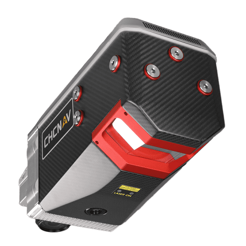
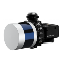
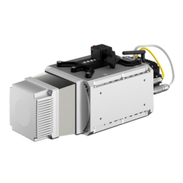
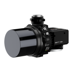
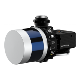
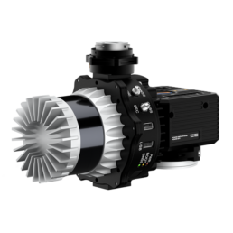
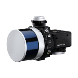
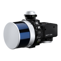
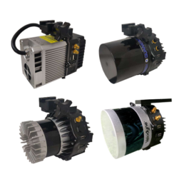
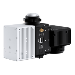
CHCNAV AlphaAir 2400 Airborne LiDAR System
The AlphaAir 2400 from CHC Navigation is a premium airborne LIDAR system designed for use on various helicopters, airplanes and UAV platforms at up to 1400 m operating flight altitude.
Description
Overview
The AlphaAir 2400 from CHC Navigation is an airborne LiDAR solution that includes a laser scanner offering an impressive combination of low weight, extended range, high accuracy, and scanning speed for missions at up to 1400 m operating flight altitude. The AA2400 can be easily installed on helicopters or airplanes but also on various UAVs, such as CHCNAV’s BB4.
The AA2400 system integrates a Riegl’s VUX-240 laser scanner with a unique forward and backward-looking FOV designed to minimize laser shadowing and provide geometry of complex vertical structures in a single pass. In addition, the VUX-240 airborne laser scanner features a wide 75-degree field of view and a high-speed data acquisition rate of up to 1.8 MHz and a scanning range of up to 2150 meters.
The industrial-grade GNSS and high precision IMU allow the AlphaAir 2400 to provide up to 2 cm accuracy, depending on the scanning range. The AA2400 allows users to survey large areas and avoid potential collisions with high objects. The acquisition time is significantly reduced, especially for large corridor mapping projects from helicopters or aircraft.
Up to four cameras in nadir or nadir and oblique view with a high resolution of 100-150 MP, such as a PhaseOne camera, can be added to the AA2400. By obtaining high resolution geo-referenced and/or oblique imagery, more applications can be supported increasing the return on investment for the client.
The continuously rotating polygonal mirror wheel enables scan speeds of up to 400 lines per second, ideally suited for high point density corridor mapping applications. The over-density of accurate data makes the results of point cloud processing, such as drawings, 3D models, or DTMs, more accurate.
The AlphaAir 2400 is easy to install; one click connects the AlphaPort to the power source; a second click starts the LiDAR. The AA2400 eliminates the need for additional accessories and camera calibration time. It can be installed with increased protection against potential damage on various airborne platforms and operated from up to 8 km range with its embedded remote control system.
The software package developed by CHCNAV allows a complete LiDAR solution to be added to the users’ geomatics services. Fully automated reality capture and real-time mission tracking are performed with CoCapture UAV software and semi-automatic point cloud processing using CoPre desktop software.
Features
- Outstanding Data Acquisition at High Altitude
- Can Control up to Four External Cameras
- Extreme Productivity and Data Quality
- Easy Installation and Operation
- Comprehensive Ecosystem
- Alphaport Interface
- 3x Scan Directions
Technical Specifications
| General System Performance | |
| Absolute Hz & V Accuracy: | < 0.050 m RMS |
| Accuracy Conditions: | Without control points, @100 m flight altitude AGL |
| Mounting: | The connection between equipment and aircraft uses quick disassembly structure, simple and easy to operate. There is no cable between unit and aircraft, camera and unit. |
| Weight: | 5.05 kg |
| Dimensions: | 34.0 cm × 16.4 cm × 20.6 cm (13.38 in × 6.45 in × 8.11 in) |
| Communications: | 1 x Alphaport to power the unit, 1 x RS232 port to connect the camera, 1 x RS232 data transfer port |
| Remote Control: | Up to 8 km, wireless control of instrument parameters and data recording in real time |
| Data Storage: | 1 TB internal SSD |
| Point Density on Airborne Setup 10.3 m/s (20 kn) Speed: | 800 pts/sqm @ 120 m AGL |
| Laser Scanner | |
| Laser Class: | 3R (in accordance with IEC 60825-1:2014) |
| Max. Range, Reflectivity > 80%: | 2150 m |
| Max. Range, Reflectivity > 20%: | 1200 m |
| Max. Operating Flight Altitude AGL, Reflectivity > 60%: | 1400 m |
| Minimum Range: | 5 m |
| Accuracy: | 20 mm |
| Precision: | 15 mm |
| Field of View: | ±37.5° = 75° |
| Maximum Scan Rate: | 1,800,000 shots/sec |
| Scan Speed (Selectable): | 40-400 scans/sec |
| Max. Returns Supported: | 5 to 15 (depending on selected scan rate) |
| Positioning & Orientation System | |
| GNSS System: | Multiple GPS, GLONASS, Galileo, BeiDou, SBAS and QZSS constellation, L-Band |
| IMU Update Rate: | Standard 100 Hz (user selectable up to 600 Hz) |
| Position Accuracy NO GNSS Outage: | 0.010 m RMS horizontal, 0.010 m RMS vertical, 0.005 degrees RMS pitch/roll, 0.010 degrees RMS heading |
| Imaging System | |
| Camera Type: | Modular upgrade options: DSLR, thermal, multispectral |
| Airborne Default Camera Setup: | CHC AS-C4200 (calibrated Sony A7 RII) |
| Resolution: | 7952 x 5304, 42.4 MP, 5 fps |
| Environmental | |
| Operating Temperature: | -10 °C to +40 °C |
| Storage Temperature: | -20 °C to +50 °C |
| IP Rating: | IP64 |
| Humidity (Operating): | 80%, non-condensing |
| Electrical | |
| Input Voltage: | 24 V (wide range 11 V ~ 34 V) |
| Power Consumption: | 95 W |
| Power Source: | Depending on aircraft or UAV battery |
Ordering
The AlphaAir 2400 airborne LiDAR system from CHC Navigation is available through Canal Geomatics. If you would like more information about this product, please feel free to get in touch with us by completing the Request Pricing form.
