
Top 5 Applications of NovAtel GNSS Technology in High-Precision Industries
Introduction to NovAtel GNSS Technology When precision is the key to success, GNSS technology…

Why UHF Radios Are Essential for Reliable Data Transmission in Remote Areas
Introduction to UHF Radios in Geospatial Applications When working in remote areas, reliable data…

Compass Geomatics vs. Canal Geomatics: How to Choose the Right Partner for Your Positioning Needs
Understanding the Importance of Choosing the Right Partner Selecting the right partner for your…

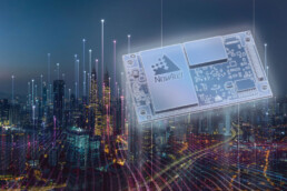
Understanding GNSS Receivers: A Comprehensive Guide for Industry Professionals
Exploring the Role of GNSS Receivers Global Navigation Satellite Systems (GNSS) play a crucial role…

The Role of Hemisphere GNSS in Enhancing Marine and Aerospace Applications
Understanding Hemisphere GNSS Hemisphere GNSS is renowned for its cutting-edge positioning…

Why Tallysman Antennas Are the Gold Standard for Precision Positioning
The Evolution of GNSS Antenna Technology GNSS technology has seen significant advancements over the…

Fiber Optic Gyros vs. Traditional Gyroscopes: What You Need to Know
Understanding Traditional Gyroscopes Traditional gyroscopes, also known as mechanical gyroscopes,…
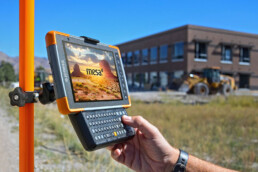
A Deep Dive Into Juniper Systems: Rugged Computing for Extreme Environments
The Legacy of Juniper Systems Juniper Systems has built a reputation as a leader in rugged…

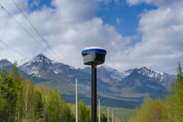
How GNSS Antennas Improve Accuracy in Agricultural and Construction Projects
The Role of GNSS Antennas in Precision Agriculture GNSS antennas have become indispensable in…

Top 5 Benefits of Using Smart Antennas for Geospatial Projects
Enhanced Positioning Accuracy Smart antennas are a game-changer when it comes to achieving precise…
Why Canal Geomatics Is Your Trusted NovAtel Distributor in North America
Canal Geomatics: A Legacy of Excellence Canal Geomatics has built a solid reputation as a trusted…
Maximizing Efficiency with UHF Radios in Surveying and Mapping
Understanding UHF Radios in Surveying UHF radios are a critical component in modern surveying…