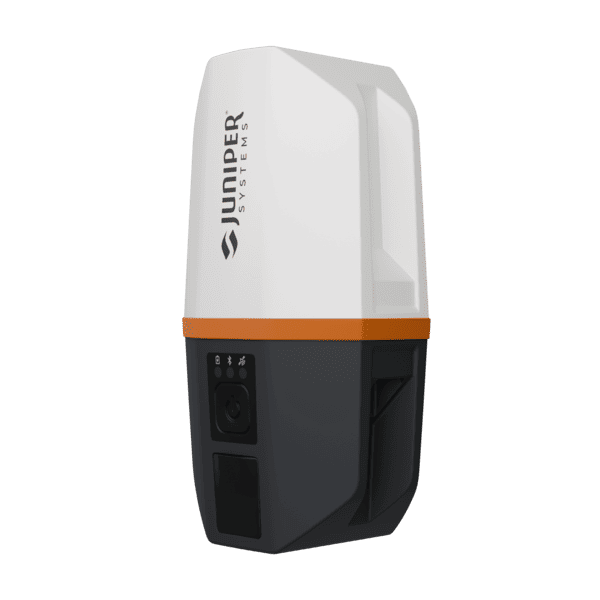


Juniper Spire GNSS Receiver
The Juniper Spire SP1 is a lightweight, multi-frequency RTK GNSS receiver designed for GIS professionals, surveyors, and field crews who need centimeter-level accuracy without the complexity.
RTK-ready right out of the box, the Spire SP1 supports SBAS and Network RTK corrections and tracks all major satellite constellations, GPS, GLONASS, Galileo, BeiDou, QZSS, and NavIC, for reliable precision positioning in any environment.
With one-button operation, a 20-hour battery, IP68 rugged construction, and seamless Bluetooth connectivity to any iOS, Android, or Windows device, the Spire SP1 is Juniper Systems’ most portable and accessible high-accuracy GNSS receiver to date.
Description
Overview
Looking for an affordable RTK GNSS receiver that delivers centimeter-level accuracy right out of the box, without the complexity of traditional survey-grade systems?
The Juniper Spire SP1 GNSS Receiver is a compact, multi-frequency precision GNSS receiver designed for GIS mapping professionals, surveyors, utility inspectors, and environmental monitoring teams who need reliable, high-accuracy field data collection without the steep learning curve.
Built around a rugged helical antenna and a multi-constellation GNSS engine, the Spire SP1 supports SBAS and Network RTK corrections right out of the box, delivering positioning accuracy from sub-meter down to 2 centimeters. Whether you’re collecting GIS data in dense urban environments or remote field sites, this lightweight RTK-ready receiver adapts to your accuracy needs and integrates seamlessly with iOS, Android, and Windows devices via Bluetooth or USB-C, no external antennas or cables required.
Juniper Systems designed the Spire SP1 to be their lightest and most versatile GNSS receiver to date. Pair it with the Juniper RTK correction service, powered by Point One Navigation’s growing NTRIP network, and you have a complete, end-to-end centimeter-accuracy mapping solution with minimal setup, making it one of the most accessible Network RTK receivers for GIS and asset mapping on the market today.
Features
- Centimeter-Level RTK Accuracy – Network RTK support delivers positioning data down to the 2-cm range for precise GIS mapping, utility surveying, and asset inventory
- RTK-Ready Out of the Box – SBAS and Network RTK corrections included with no complex configurations required
- Worldwide GNSS Corrections – Supports SBAS (WAAS, EGNOS, MSAS, GAGAN, BDSBAS, SouthPAN), Network RTK via NTRIP, and future correction services
- Multi-Constellation Tracking – Simultaneously tracks GPS, GLONASS, Galileo, BeiDou, QZSS, and NavIC for maximum satellite visibility in any environment
- Multi-Frequency GNSS Receiver – L1/L2/L5 multi-frequency support for faster RTK convergence and improved accuracy
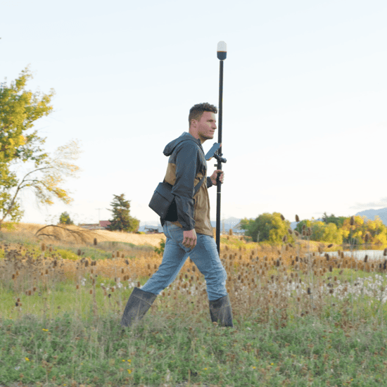
- Lightest Juniper GNSS Receiver Yet – At just 330 g, the Spire SP1 is Juniper Systems’ most portable precision GNSS receiver, ideal for all-day field use
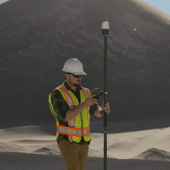
- Open Platform Compatibility – Works with any iOS, Android, or Windows data collection app including ArcGIS Field Maps, ESRI Survey123, SW Maps, and more
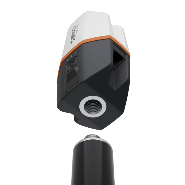
- One-Button Operation – Simple, intuitive design with no cables or external antennas for fast deployment in the field
- All-Day Battery Life – 20-hour runtime on a single charge powers through the most demanding field workdays
- Juniper Rugged™ Construction – IP68-rated, MIL-STD-810H certified, and built to perform from -20°C to +60°C
- Designed & Assembled in USA – Manufactured by Juniper Systems in Logan, Utah
Technical Specifications
| Receiver | |
| Receiver Type: | GNSS multi-frequency, multi-constellation |
| GPS: | L1CA, L2C, L5 |
| GLONASS: | G1, G2I |
| Galileo: | E1BC, E5a, E6 |
| BeiDou: | B1I, B1C, B2a, B3 |
| QZSS: | L1CA, L1CB, L2C, L5, L6 |
| NavIC: | SPS-L5 |
| SBAS Support: | WAAS, EGNOS, MSAS, GAGAN, BDSBAS, SouthPAN |
| Update Rate: | 1 Hz standard (up to 20 Hz) |
| Accuracy | |
| SBAS/SLAS: | 0.7 m (horizontal RMS) |
| RTK (Fixed): | 1.5 cm + 1 ppm (horizontal RMS) |
| Autonomous: | 1.2 m (horizontal RMS) |
| Cold Start: | 27 sec typical (no almanac) |
| Reacquisition: | 2 sec |
| Antenna | |
| Antenna Type: | Internal precision quadrifilar helical antenna |
| Communications | |
| Bluetooth: | Version 4.2 BR/EDR Class 1 |
| USB-C: | Data transfer and charging (115200 Baud) |
| Receiver Protocols | |
| Data I/O Protocol: | NMEA-0183 4.11, UBX Binary (proprietary) |
| Correction I/O Protocol: | RTCM v3.x |
| Juniper Rugged™ | |
| Operating Temperature: | -20°C to +60°C (-4°F to +140°F) |
| Storage Temperature: | -30°C to +60°C (-22°F to +140°F) |
| Drop/Vibration: | Meets or exceeds MIL-STD-810H |
| Enclosure Rating: | IP68 (1 m for 45 min) |
| Dimensions | |
| Size: | 143 mm x 78 mm x 60 mm (5.65 in x 3.05 in x 2.36 in) |
| Weight: | 330 g (11.6 oz) |
| Mount: | 5/8-11 UNJC |
| Power | |
| Input Voltage: | 5 V DC @ 3 A USB |
| Power Consumption: | 1 W nominal |
| Battery: | Overtime II Technology™ 3.6 V 5500 mAh Li-ion |
| Run-Time: | 20 hours |
| Charging Time: | 6 hours |
| Storage | |
| Internal Storage: | 512 MB Flash memory |
Compatibility
The Juniper Spire SP1 is compatible with virtually any GIS data collection platform and mobile operating system, making it a truly open, BYOD-friendly precision GNSS receiver:
- Windows® 10 and later
- Android™ 8 and later
- iPhone and iPad (see Juniper Systems’ website for a full list of compatible Apple™ devices)
- Works with popular GIS apps including Esri ArcGIS Field Maps, Survey123, SW Maps, QField, Fulcrum, and more
- Juniper Connect™ software provides configuration, NTRIP communications setup, and receiver settings
Included Accessories
- AC power supply
- Adapter kit (EU/UK)
- USB-C cable
- 5/8-11 to 1/4-20 adapter
- User manual (available in English, French, German, and Spanish)
Warranty
The Juniper Spire SP1 GNSS Receiver comes with a two-year warranty covering defects in materials and workmanship under normal use, for a period of 24 months from the date of shipment. Accessories come with a 90-day warranty. Extended service and maintenance plans are also available through Juniper Systems.
Why Buy from Us?
Serving the geomatics industry since 2004, Canal Geomatics has established itself as a leading distributor of high-precision GNSS receivers and positioning solutions in North America. Our mission is to match each customer with the right solution for their specific application, whether that’s sub-meter GIS mapping or centimeter-level RTK surveying, and to provide the technical support needed to maximize their investment in the field. If you’re evaluating the Spire SP1 alongside other RTK GNSS receivers, our team is here to help you make a confident, informed decision.
Ordering
The Juniper Spire SP1 GNSS Receiver is available through Canal Geomatics. For pricing information or to discuss your precision GNSS requirements, please get in touch with us by completing the Request Pricing form.