CHCNAV CoPre LiDAR Processing Software
CoPre LiDAR processing software from CHC Navigation is an advanced, user-friendly 3D laser scanning data processing software to capture processed raw data, including POS trajectories, LiDAR data and RGB images.
Description
Overview
CoPre is a powerful software ecosystem developed by CHCNAV that enables users to quickly and efficiently process mobile geospatial mapping data. CoPre features accurate trajectory processing by a proprietary algorithm, point cloud and image georeferencing, point cloud colorization, filtering, and additional useful functions such as digital ortho model (DOM) generation, leading to the significant improvement of the post-processing accuracy.
CoPre is built around a simple and intuitive user interface. Geospatial professionals can export point clouds and image files without opening third-party software for the positioning and orientation system (POS) computations. It enables the analysis of complex information structures with absolute precision and empowers the world of 3D data processing. CoPre software is the backbone of CHCNAV’s LiDARs system series and it’s regularly updated with new features, functionality, and tools.
CoPre desktop software provides instant access to raw data from all the CHCNAV LiDARs systems. Whether you want to process data from the compact AlphaAir 450 mobile mapper for UAVs, perform massive data processing from the vehicle-mounted Alpha3D, or get the results of your corridor mapping project with the AlphaAir 1400 or AlphaAir 2400 on a helicopter, CoPre supports all your mapping scenarios.
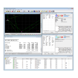
For the experts searching to optimize their data quality further, CoPre features an advanced processing mode. It handles the layering problems of multiple point clouds and improves the relative accuracy through an efficient strip adjustment algorithm. Additional use of ground control points (GCP) is available to improve the absolute accuracy of the point cloud. The advanced calibration and optimization technology results in a point cloud thickness that is 30% less than similar products provide on the market.
All LiDAR data processing starts with the first and main step of trajectory generation. CoPre is powered by the accurate and efficient algorithm developed by CHCNAV to process captured raw data, including trajectory (POS) files, LiDAR data and RGB images. Multiple data sets can be processed simultaneously to increase workflow efficiency, solving the problem for SLAM based units of updating a map of an unknown environment while simultaneously keeping track of the location within it.
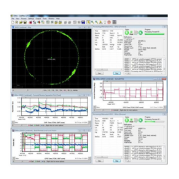
CoPre includes different powerful options to check the data after the processing steps. It supports massive data sets visualization with multiple colorization options. Its automatic trajectory slicing and stratification checking allow quick detection of misalignments across the entire data set. Elevation accuracy can be automatically verified by importing elevation control points. Multiple accuracy reports are available to address quality control requirements.
Built on significant expertise in mobile mapping data collection, CHCNAV’s solutions are designed to ensure high efficiency in the data processing. CoPre supports automated point cloud processing, image georeferencing, point cloud colorization, depth maps, and results output in a single click. Users can take full advantage of CHCNAV airborne LiDAR systems for data capture, as CoPre supports rapid DOM generation and analysis without any other software. Furthermore, the DOM generation algorithm in CoPre is a combination of photos and point clouds without a three-dimensional triangulation process.
Ordering
The CoPre LiDAR processing software from CHCNAV is available through Canal Geomatics. If you would like more information about this product, please feel free to get in touch with us by completing the Request Pricing form.


